Rast auf einer Bank

Pellenzer Seepfad

Hike along the Eifel Traumpfad Pellenzer Seepfad (Pellenz Lake Trail)

Unique glimpses into the volcanic history on the Eppelsberg mountain. Live volcanism at Lake Laacher, with a view of Maria Laach Abbey, fantastic views of the Kruft Forest Lake and wonderful views of the Pellenz.

current route information

Description

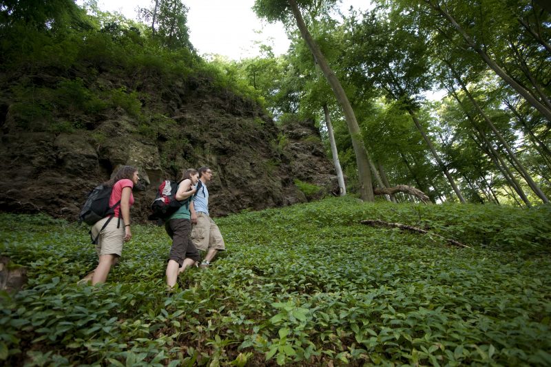
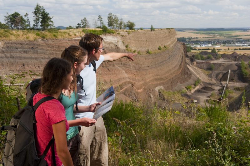
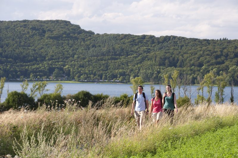
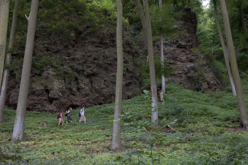
The tour starts at the carpark near the Roman tumulus in Nickenich. The path first goes round an idyllic valley before a short climb goes past an impressive ash wall (black wall). This site is just as impressive as the wide view of Nickenich.

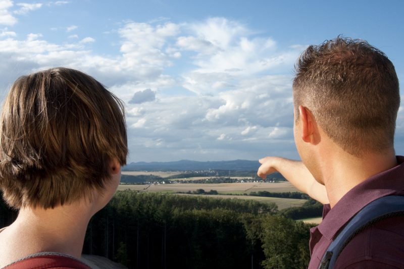
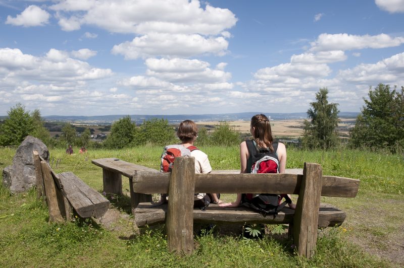
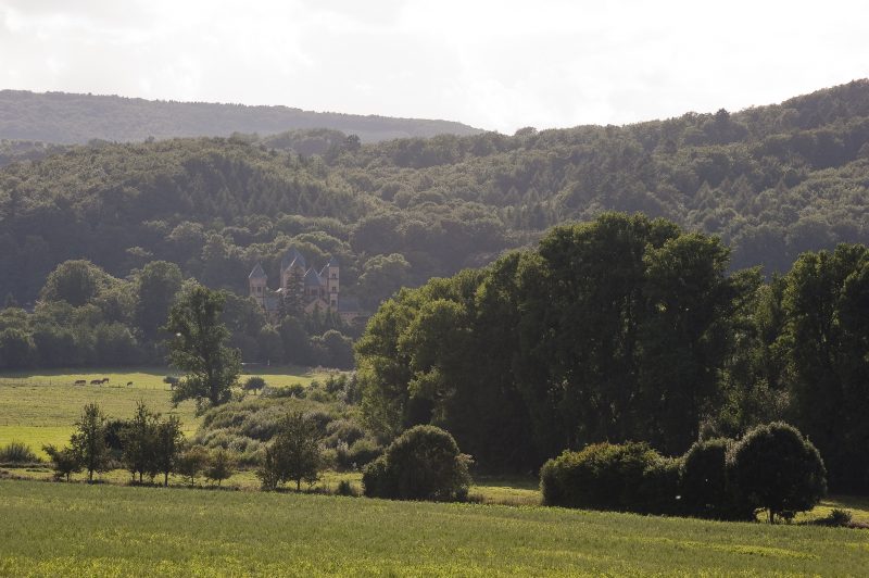
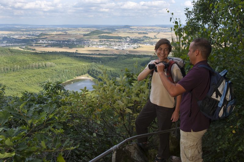
After a short climb, a detour to a rest at the Hermann Hut is rewarding with its fantastic panoramic view. Afterwards the trail goes slightly downhill and goes past the edge of the mining pit at the Eppelsberg. After a passage through a mixed forest a resting place at the Kruft Forest Lake is reached. The assault to the summit starts on gently climbing forest paths, but shortly before the rock the path becomes very steep uphill, along an impressive recess in the rock to a rock spur called Teufelskanzel with a fabulous distant view towards Kruft and the Neeuwied basin. A comfortable ridge path leads to the refuge hut “Am Krufter Ofen” (Kruft Oven), then the path goes in serpentines downwards through a mighty beech forest. The path continues across open fields to Lake Laacher and reveals the first glimpses of the Maria Laach Abbey.

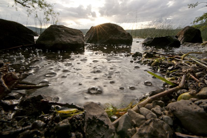
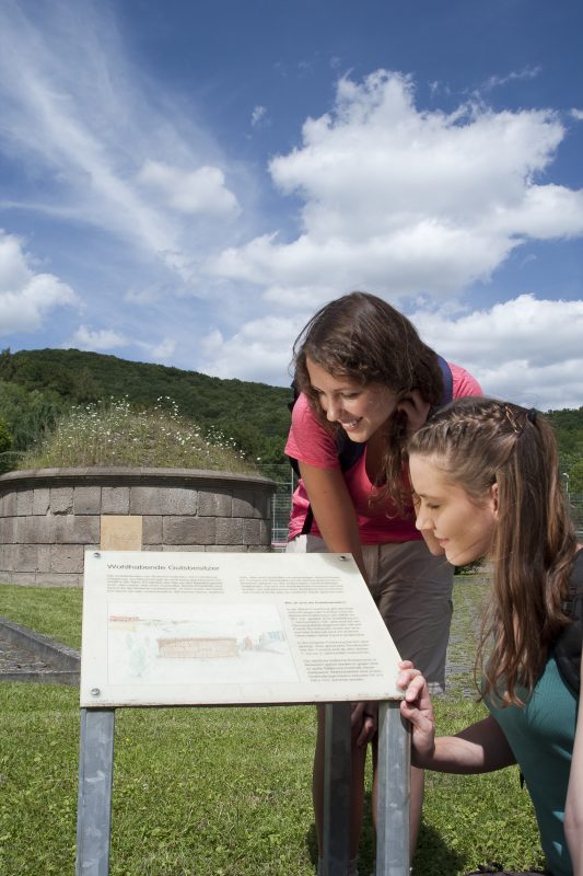
A detour along the nearby bank to the lake is rewarding to marvel at the so-called mofettes. Soon the path turns right and climbs steeply upwards. Finally, comfortable forest paths lead over the L 116 and initially through mixed forest to the celtic tree circle. The last part of the stretch is characterised by recurring great views of the Siebengebirge mountain range and the Pellenz hills. Continuing along the edge of the forest, the path curves round the sportsfield back to the Roman tomb.

Highlights at Traumpfad

  • Ash wall of the Lake Laacher volcano
  • Kruft Forest Lake
  • Rock spur Teufelskanzel
  • Fantastic panoramic views of the Siebengebirge mountains and Pellenz hills
  • Lake Laacher with a view of the Benedictine Abbey Maria Laach
  • Nickenich tumulus (Roman tombs)

Information about Traumpfad "Pellenzer Seepfad"

Length

16 km

Altitude

594 m

Duration

5 hours

Difficulty

hard

How to get there
Start
Further access
3d-Flight
Public transport
  • A61 Exit Kruft
  • B256 to Kruft
  • L119 towards Nickenich
  • 56645 Nickenich, Laacher Straße, car park at Tumulus
56645 Nickenich car park at Tumulus (Laacher Straße)
  • 56645 Nickenich Parkplatz Kellerkreuz (L 116)
  • 56642 Kruft Parkplatz am Waldsee (K 53)
  • 56653 Maria Laach Benediktinerabtei Maria Laach (Parkgebühren 2 €)
Mit dem Klick aktivieren Sie das Video, es werden aber Daten, wie Ihre IP-Adresse, zu Youtube übertragen.
Video anzeigen
Destination Stop:
Nickenich, Oberdorf
Lines:
  • Linie 395 Niedermendig - Maria Laach - Nickenich - Andernach

Destination Stop:
Kruft, Bahnhof
Lines:
  • RB 23 Kaisersesch-Mayen-Andernach - Pellenz-Eifel-Strecke (Lahn-Eifel-Bahn)
  • RB 38 Kaisersesch-Mayen-Andernach - Pellenz-Eifel-Strecke (Lahn-Eifel-Bahn)

Links


Impressions from the Traumpfad "Pellenzer Seepfad"

Notes

current route information
Holzerntearbeiten (Sperrung Alternativroute Teufelskanzel)

Das Forstrevier Laacher See führt ab dem 05.01.24 Holzerntearbeiten im Bereich unterhalb der Teufelskanzel durch. Hierfür muss der Weg (Umleitung-moderater Anstieg) jeweils von Montag bis Freitag von 7.30-16.00 gesperrt werden. Der steile Aufstieg zur Teufelskanzel bleibt vorerst frei. Wir gehen derzeit davon aus das es bis zum 26.01.24 in diesem Bereich zu Einschränkungen kommen wird.

(Gültig von 05.01.2024 bis 26.01.2024)
Alternativroute Teufelskanzel

Der Pellenzer Seepfad hat im Bereich der Teufelskanzel eine alpine Streckenführung. Hier ist Trittsicherheit erforderlich, da vor allem bei Nässe erhöhte Rutschgefahr besteht. Es wurde eine Alternativroute ausgewiesen, um diesen Bereich zu umgehen.


Explore more Traumpfade

wanderather traumpfad

Wanderather

Length: 12 km

Difficulty: leicht

go to Traumpfad "Wanderather"
Traumpfade 1

Waldseepfad Rieden

Length: 14,2 km

Difficulty: moderate

go to Traumpfad "Waldseepfad Rieden"
Mutter und Tochter befühlen Wacholderheiden

Wacholderweg

Length: 8,8 km

Difficulty: moderate

go to Traumpfad "Wacholderweg"
Vulkanpfad Wanderweg

Vulkanpfad

Length: 6,6 km

Difficulty: moderate

go to Traumpfad "Vulkanpfad"
Traumpfade 2

Virne-Burgweg

Length: 9,9 km

Difficulty: moderate

go to Traumpfad "Virne-Burgweg"
Traumpfade 3

Vier-Berge-Tour

Length: 12,9 km

Difficulty: hard

go to Traumpfad "Vier-Berge-Tour"
nette schieferpfad

Nette-Schieferpfad

Length: 9,2 km

Difficulty: moderate

go to Traumpfad "Nette-Schieferpfad"
Traumpfade 4

Monrealer Ritterschlag

Length: 13,7 km

Difficulty: hard

go to Traumpfad "Monrealer Ritterschlag"
Zwei Wanderer rasten auf einem Felsen

Hochbermeler

Length: 10 km

Difficulty: leicht

go to Traumpfad "Hochbermeler"
heidehimmel-volkesfeld

Heidehimmel Volkesfeld

Length: 9,3 km

Difficulty: moderate

go to Traumpfad "Heidehimmel Volkesfeld"
Traumpfade 5

Förstersteig

Length: 14,7 km

Difficulty: hard

go to Traumpfad "Förstersteig"
Wanderer kühlen ihre Füße ab

Booser Doppelmaartour

Length: 9,1 km

Difficulty: easy

go to Traumpfad "Booser Doppelmaartour"
Traumpfade 6

Bergheidenweg

Length: 10,3 km

Difficulty: moderate

go to Traumpfad "Bergheidenweg"
Our partners